
I have spent the last 24 years living in and traveling to more than 60 countries. I love slow travel, spending time immersing myself deeply into places, and I love going back to places that feel like home to me (i.e. I have been to Chile more than 10 times in 10 years).
Someone recently asked me, “What is your dream adventure?”… as in, where do I really want to go, anywhere in the world?…
After considering this for about a minute, I knew my answer, and it didn’t surprise me: “I want to drive and camp the Carretera Austral in Chilean Patagonia. Again.”
In December of 2017, by a series of very fortunate and strategic events, I had the invitation and privilege of jumping into a friend’s car and driving and camping the entire length of the Carretera Austral in Chilean Patagonia. To this day, I still look back on those three weeks as three of the most free and adventurous weeks of my life.
Why wouldn’t I want to do that again? Of course there are some details I’d change, but my trip in 2017 was near perfect.
In this post I share my itinerary, helpful anecdotes, stories, and thoughts from that experience and include even more places that I have been along the way in the years since my original trip.
Also, because I actually want you to feel like traveling the Carretera Austral is something you can do, too, I’m going to start with this:
Disclaimer
I realize it’s not at all normal to already happen to be in Patagonia and just happen to have an invite to jump in a car that happens to already be packed and ready for the entire experience (literally the only prep I had to do was procure a sleeping bag for myself). It was so easy, and I will be forever grateful that I got to say yes to my first experience on the Carretera Austral in such a no-brainer way.
My travel buddy Ford and I figured everything out as we went, without a real plan or any outside help. But, we also had both spent months in the region before and both speak fluent Spanish. We weren’t worried about much at all except maybe having car issues.
I’m nearly certain none of the above will describe your own situation. Therefore, I have great news and not-so-great news for you.
The not-so-great news about planning any trip to Patagonia:
Logistics in Patagonia are complicated on a good day. Insert bad weather, bad roads, landslides, stuck supply trucks, non-English speakers, lack of cell service, and anything else that absolutely will happen during your travels in this remote corner of the earth, and you have yourself a very complicated trip to plan, especially from afar.
The GREAT news about planning any trip to Patagonia:
My friends at EcoChile can help you plan your trip down to the very last detail. (And you can get a 5% discount through me – read on!)
EcoChile (& EcoArgentina) are travel experts in all of Chile and Argentina and beyond. They work with all the local companies. They can set up every adventure I mention in this post, plus get you a car and adventure gear and everything else you need. They can even get your international flights if you want them to. And they will help guide you every step of the way. They are so good at what they do, because they live and travel in Chile themselves. They are locals who know these regions well (bonus: they also speak great English).
Send an email to info@ecochile.travel and his team will help you build your dream trip to the Carretera Austral. Whether it’s just a couple or ALL of your trip details along the way, they can help.
Tell them Traveling Jackie sent you and they’ll give you 5% off any trip you book with them, whether it’s the Carretera Austral, Easter Island (I went there through them last year!), Torres del Paine, or anywhere else in Chile and Argentina that you can dream of. They are amazing at what they do, you will see!
In 2025 I actually invited the founder of EcoChile Christian Morrison to join me on the podcast to talk about a recent trip he did in this exact place – the Carretera Austral, listen here:
Alright, buckle up. Here we go into my dream adventure… to the land that was runner up for the filming of Middle Earth from the Lord of the Rings (yep – it’s that beautiful, but Peter Jackson deemed it too inaccessible for movie crews – so it’s also that remote!).
Author’s Note: The remainder of this post was originally written in 2018 and is published here in 2026 with many updates and never-before-told stories. This post contains affiliate links – thanks for using them!
I am ruined for life. After driving the length of the Carretera Austral in Chilean Patagonia and seeing the most beautiful mountains, rivers, hanging glaciers, valleys, fjords, volcanoes, and more, I just don’t know what can possibly top the beauty of this region.
If you want to take the ultimate adventure road trip of a lifetime, put the Carretera Austral on your bucket list right now.
The Carretera Austral
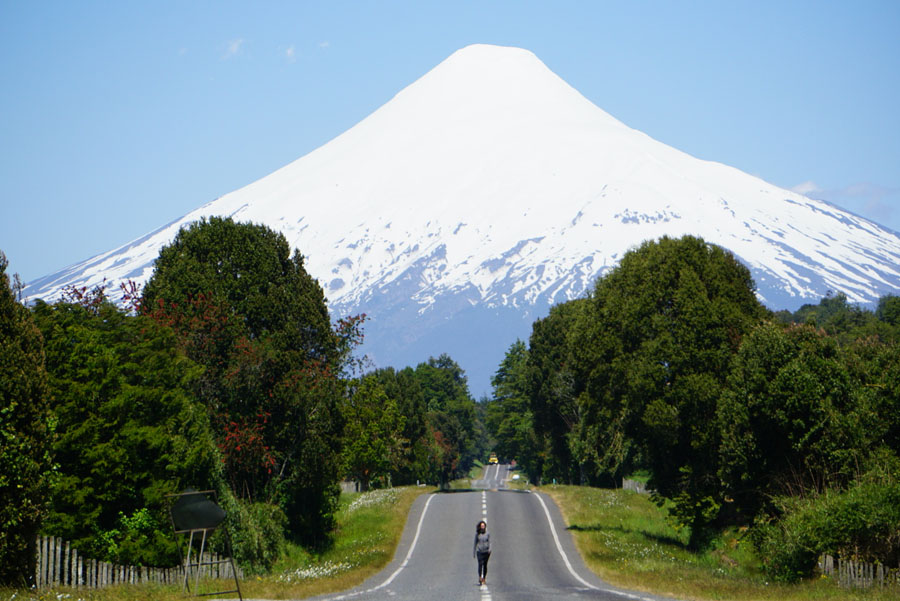
The Carretera Austral, which can be translated to “Southern Highway,” is a stretch of “road” almost 800 miles long that spans the length of Northern to Central Chilean Patagonia.
This part of Chile is still very primitive and wild, and this “highway” was only constructed within the last several decades to connect towns previously only reachable by boat. It consists of segments of dirt road (“ripio” locally), multiple ferries, bridges, and more paved stretches with each passing year.
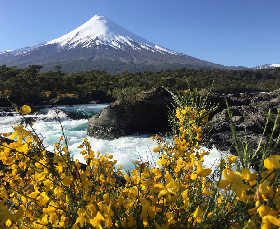
The road passes through the absolute most incredible landscape on the earth (IMO), including many protected areas and national parks that make up Chile’s Route of the Parks.
The Carretera Austral is an outdoor adventure seeker’s ultimate playground.
Make it easy: If YOU want to drive the Carretera Austral, reach out to EcoChile to arrange your trip details. Tell them Traveling Jackie sent you and save 5% off ANY trip you book with them!
How I Managed to Get a Car (and Driver!)
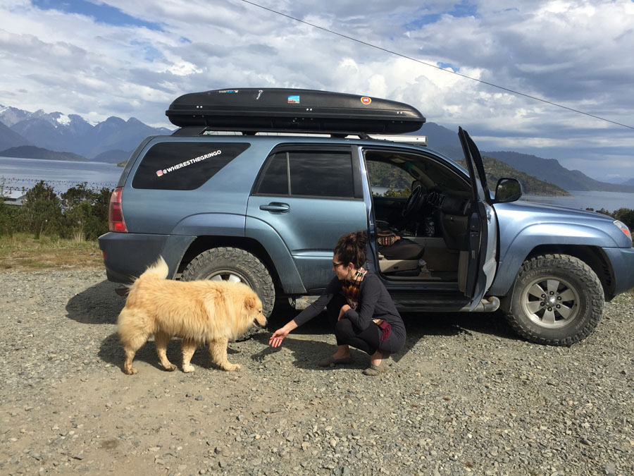
If you listen to my podcast, you may remember my interview with Ford Quarterman (episode 81) about his travels from the US down through Latin America in his Toyota 4Runner named Cielito Lindo.
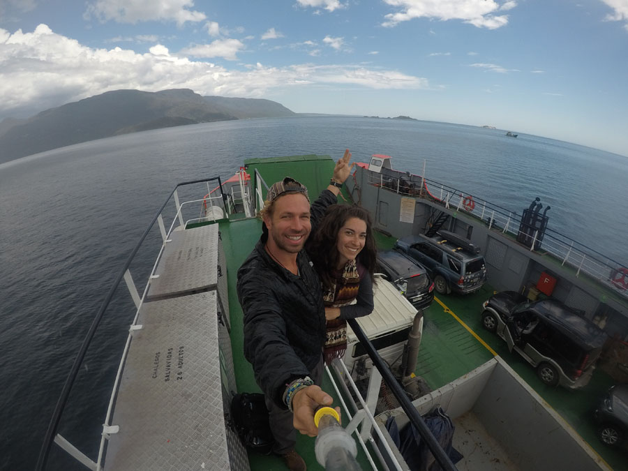
As is true with most of my podcast guests, we hadn’t met in person before, but during that conversation, we figured out that we would be in Patagonia at the same time (I led a group trip there in November 2017). With the opportunity of a lifetime sitting right in front of us, we both said yes and agreed to road trip the Carretera Austral together.
Listen to a reunion episode with Ford and I as we talk about this trip together on the show (episode 89):
In December of 2017, we met up in Bariloche, Argentina, drove across the border to Puerto Varas, Chile, and spent the next month camping, hiking, and exploring our way south. This post is a chronicle of our Carretera Austral adventure, with itinerary notes, road trip advice, camping tips, and must-do’s along the way.
Camping and driving your own vehicle is absolutely the best way to experience all that the Carretera Austral has to offer.
Renting a Car to Drive the Carretera Austral
If you don’t happen to know anyone driving their Toyota to the end of the world, you can rent a vehicle locally in Chile. We met tons of people from lots of different countries who had come to Chile and rented cars for weeks at a time.
Camping Gear
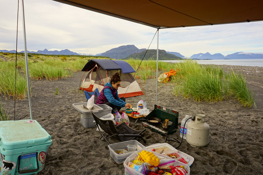
As for camping gear, Ford already had everything except a sleeping bag and pillow for me, and I coincidentally met someone who was selling her lightly used sleeping bag at our hostel in Puerto Varas. Natch. I bought a pillow at the mall and was all set.
His rig was outfitted with:
- awning that we used for sun and rain
- roomy REI tent
- two-burner stove, cooking utensils & extra gas
- Yeti cooler (ice was hard to come by – a good cooler or in-vehicle refrigerator is a MUST)
- “shit kit” (trowel, TP, hand sani, etc. for leaving no trace of your business in the woods)
- Harry Potter books in Spanish (obv)
- two camp chairs
More Must-Have Patagonia Road Trip Gear
- Bluetooth speaker
- Portable charger
- Dual port USB car charger
- Compression socks
- Eye mask and earplugs
- Rechargeable Headlamp
- See a more comprehensive list of what I keep in my pack here
- Want an adventure packing list to keep? Find it here
Know Before You Go
Download these apps:
1. iOverlander: This app contains a user-generated map of campsites, mechanics, places of interest, restaurants, hikes, parks, borders, ferries, and nearly everything else you might need on a road trip.
It works offline, which is crucial for the Carretera Austral. Everything noted on the map includes the date of entry and some sort of note or recommendation about the place.
We found all of our wild campsites through iOverlander, as well as important ferry and park information, among other helpful things. It connects easily to maps.me for specific directions to anything marked in the app.
2. maps.me: I use the pro version and have for years. Download the correct country maps while you are on WiFi and this map will be all you need for directions on the road.
It is much more detailed (even includes trails!) than either Google or Apple maps, and it is very user-friendly. Even without WiFi or cell service, you can get detailed turn-by-turn directions on the go.
Understand these issues:
- Explore: Tompkins Conservation
- Read about: Patagonia Sin Represas (Patagonia Without Dams)
- Watch: Fighting for the Futaleufú documentary (16 min)
Notes for the Carretera Austral:
- Paving is an ongoing project, expect plenty of construction at any given time.
- On a map, the Carretera Austral can also be found as Route “Ruta” 7.
- Share the road! Bikers, hitchhikers, and even runners can be spotted the entire way, around every corner. Drive cautiously.
- High season (and summertime) starts mid-December and ends mid-March, expect more people and higher prices during these dates.
- Microclimates abound, there is no such thing as predicting the weather here. Go with ALL the layers, sunscreen, and waterproof gear you can carry. And put your glasses on croakies so they don’t blow away. Seriously though.
- Three weeks is an ideal amount of time to see a lot on your way down and make it all the way to the end. Anything less and you’ll have to skip some of the must-do’s. Take as much time as you possibly can, you won’t regret one second.
- Stock up on EVERYTHING before you leave Puerto Montt and send any important messages over WiFi. Buy ALL the cheap wine, fill up on gas, etc.
- There is hardly any cell service and some small towns don’t even have WiFi. Prepare to be very off grid.
21 Days on the Carretera Austral
This Carretera Austral itinerary shares:
- Required ferries and booking info (ALWAYS check up-to-date websites for ferry info and road conditions)
- Camp spots
- Activities (hikes to glaciers, etc.)
- Beer (there are so many craft breweries to explore!)
- Extra notes
- MUST-DO activities
Keep in mind any prices and times mentioned were from 2017-2018! Do the research for updated information.
Day 1: Puerto Montt to Hornopirén
Ferry: La Arena to Puelche. Departs every 30 minutes, no reservation necessary.
Camp: We wild camped near Puntilla Pichicolo, very close to “Donde el Trauco Perdió su Poncho,” a family-run restaurant worth finding!
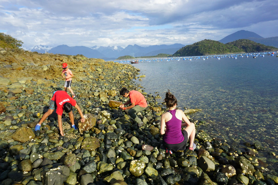
Activities: At Puntilla Pichicolo, take a walk to the water and feast on a fresh seafood buffet. Make friends with locals (humans and dogs alike!)
Notes: Make sure you have already reserved your ferry for the next day.
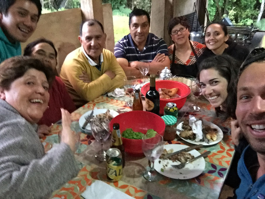
Storytime: We pulled onto a dirt road close to the ferry port and found a sort of vacant lot that we thought might be appropriate for camping. So we got out to check it out, only to have a soccer ball roll down the road to our car. It was followed by a gaggle of young boys and a very, very fluffy, sweet dog. We asked the boys if they lived here. They said yes, that their parents were just up the road in the house. We asked if they thought it would be alright if we park and camp here for the night as we wait for the morning ferry. They took our question and their soccer ball back to their front yard. A few minutes later they bounded back across the road and showed us an even better place to pull over and park down a longer drive, parents approved. They took us for a walk down to the shoreline where they showed us a plethora of fresh seafood to find among the rocks. I did not partake, but Ford certainly did. After we walked back and started setting up our camp, the boys came running back again and invited us (via their parents) to dinner! So we played soccer, hunted seafood, and ate a lovely meal with the adults of the family that night. What a way to start out Day 1 of the Carretera Austral!
Day 2: Hornopirén to Cascadas Escondidas (Parque Pumalín)
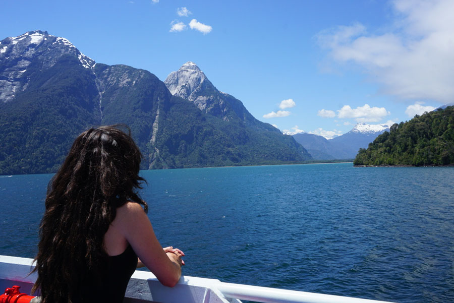
Ferry: Hornopirén to Caleta Gonzalo at 10:30 am and is a 5-hour trip. It only runs twice per day and must be reserved in advance.
It actually includes two ferries, all vehicles must disembark at Leptepú, drive together for about 10 minutes on a dirt road to Fiordo Largo, and then wait for a small ferry the rest of the way to Caleta Gonzalo.
Yes, you really do need to be there to start lining up way in advance, we started boarding at 9:30 am. This is a beautiful trip through fjords.
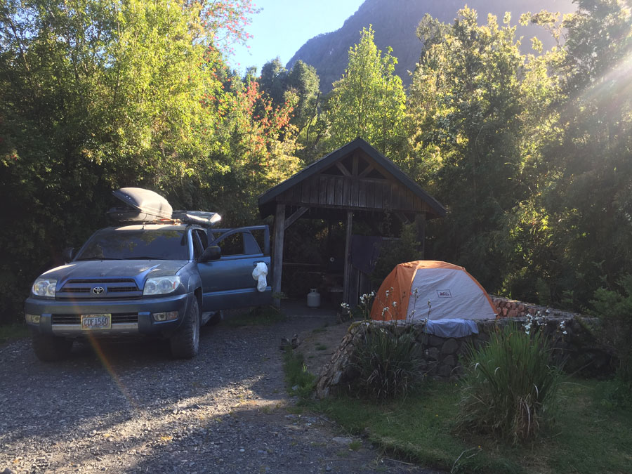
Camp: Cascadas Escondidas campground in Parque Pumalín (thanks to Tompkins Conservation). If you get there before December 15th it’s free, otherwise 5,000 CLP per person.
Activities: Hike to the waterfalls, the trail goes right out of the campground. About 3 miles and 1 hour round trip to Cascada Alta (the top waterfall and end of the trail).
Day 3: Cascadas Escondidas to Camping Ventisquero (Parque Pumalín)
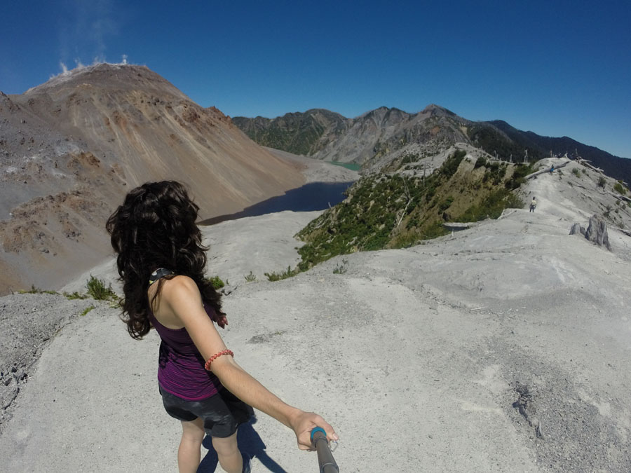
MUST-DO: Hike Volcán Chaitén. Trailhead parking lot is right on the Carretera Austral. About 3 miles round trip, took us about 45-60 minutes up and 15-20 minutes down. Very steep up (about 2,000 ft elevation gain), views are worth it. If you’re a hiker, download Strava app to track your treks!
Camp: Camping Ventisquero is also in Parque Pumalín, on the other side of the town of Chaitén. It is a BEAUTIFUL campground. There technically ARE showers but they are ICE cold. No hot water at this camp.
Notes: Restock in Chaitén for anything you didn’t buy enough of in Puerto Montt. There is also a trusted mechanic here, see iOverlander app for details. Get gas here as well. Chaitén town is not worth staying in, definitely keep going to Camping Ventisquero.
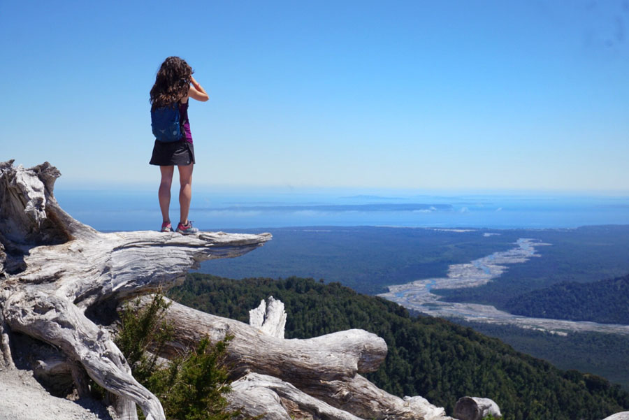
Day 4: Night 2 at Camping Ventisquero
Activities: Glacier lookout hike straight from the campground. Very short, about a mile, half hour. For a longer trek, you could do the 12-mile hike along the river to the glacier. Find it on maps.me at Camping Ventisquero – “Sendero Ventisquero.”
Notes: El Amarillo Hot Springs was closed for renovations when we tried to go there. It also seemed overpriced to us, but you could check it out. (I’ve since tried to go back to El Amarillo Hot Springs in 2023 and it was also closed then for the same reason – so good luck with this one!)
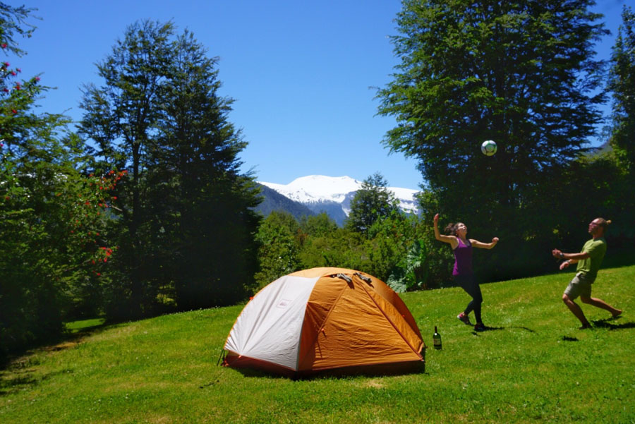
Day 5: Camping Ventisquero to Futaleufú
Activities: Hanging glacier Ventisquero Yelcho hike on the way south, parking is in an abandoned campground right before a bridge. 45-60 minutes one way, not well-maintained trail, but views are worth it. Find Ventisquero Yelcho on maps.me.
MUST-DO: Futaleufú is off the Carretera Austral by about an hour and a half, towards Argentina, but it is an incredible place. I highly recommend booking a multi-day tour with Path Patagonia. The river was dangerously high and closed to rafting or kayaking (class 6+) when we went. Instead, we did a hiking adventure and stayed at their private camps, which are absolutely bucket-list worthy on their own, not to mention the unbelievable surrounding landscapes and viewpoints from the guided hikes.
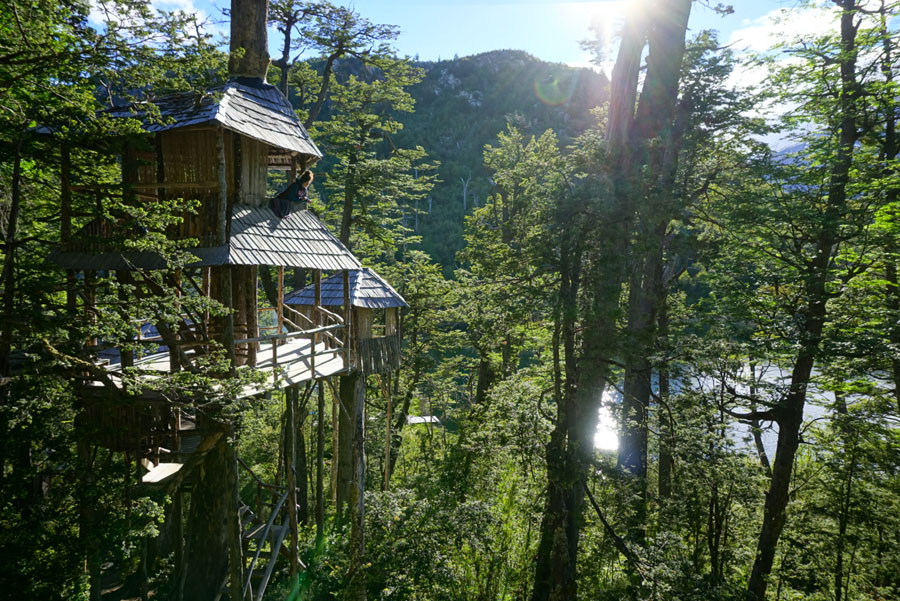
Camp: Our first night with Path Patagonia, we hiked up to a private tree house village. Think Ewok village come to LIFE, Star Wars nerds, rejoice!! This place was SO FREAKING COOL. Plus, it came with a wood-fired hot tub on the edge of a private lake, and a steak asado for dinner. We slept three stories up in the trees to the sound of a forest frog symphony, under thick sleeping bags in the cool night air. #pinchme
Notes: We were able to get cell service while passing through Santa Lucía. Please stop here and visit a store, buy something from the locals, they suffered a terrible mudslide just days after we left this area (December 2017) and much of the town was destroyed. Life is hard in these remote villages. They need your support.
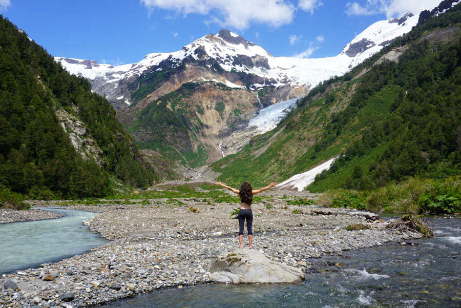
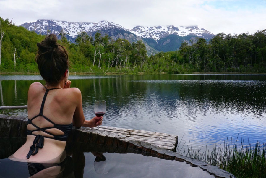
Day 6: Futaleufú – Tree House Camp to Stone House Camp
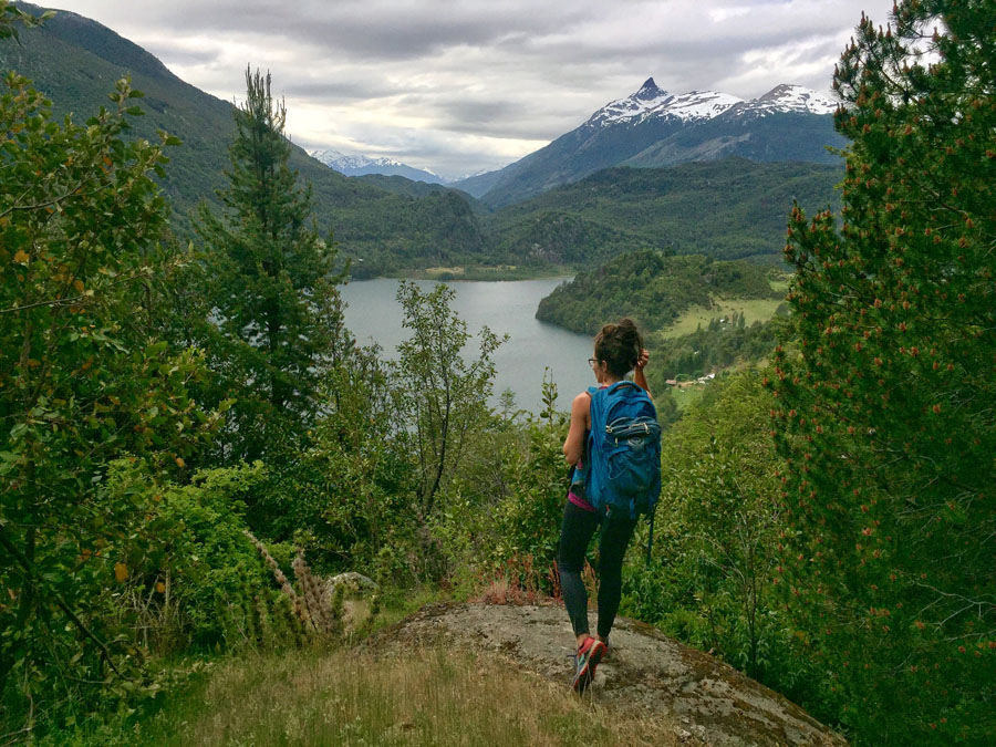
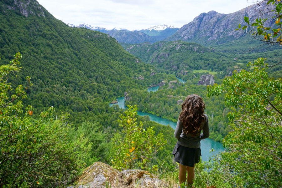
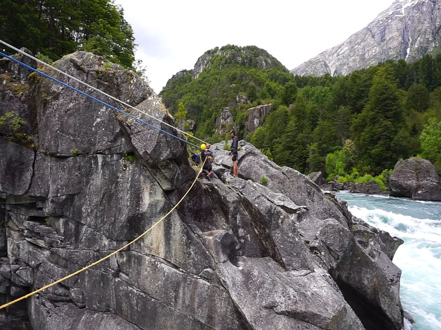
Activities: Hiked from the Tree House Camp up to a viewpoint with 360-degree views of Futaleufú and down to Stone House Camp on the biggest rapid (the “Z”) on the Futaleufú River, where we had to do a Tyrolian Traverse to get across.
Camp: Stone House Camp, with platform beds facing the Z rapid, another wood-fired hot tub, a cave, and the absolute coldest shower I’ve ever taken in my life.
Day 7: Futaleufú to La Junta
Activities: Hiked out of the Futaleufú wilderness and went into town for lunch. Decided not to stay the night, and took off for La Junta.
Camp: We opted to sleep inside for the first time and get a hot shower – stayed at Hostel Casa Museo Copihue for a ridiculous $20/pp for the night.
Notes: Get gas in Futaleufú, it’s cheaper than La Junta. Horse flies were bad on this hike! (mid December)
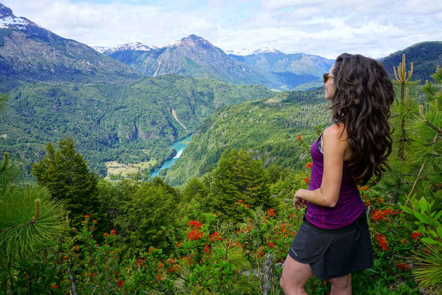
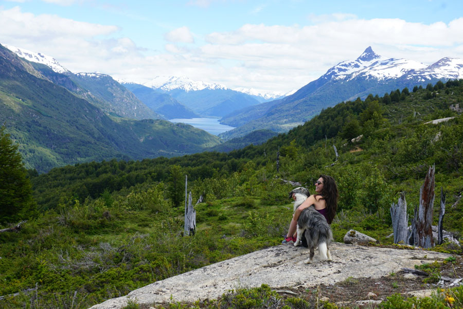
Day 8: La Junta to Raúl Marin Balmaceda
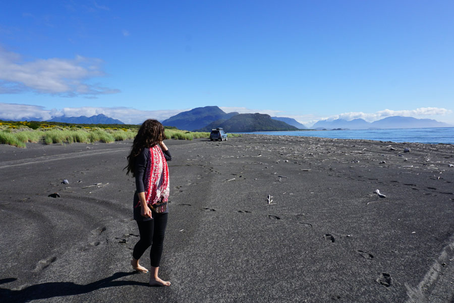
MUST-DO: Drive to Raúl Marin Balmaceda and camp on the beach.
Activities: There were hot springs on the way (Termas El Sauce), we stopped to check them out and decided they were way overpriced, so we kept going. The drive is beautiful, the beach is beautiful, hope for good weather and no wind, as we had.
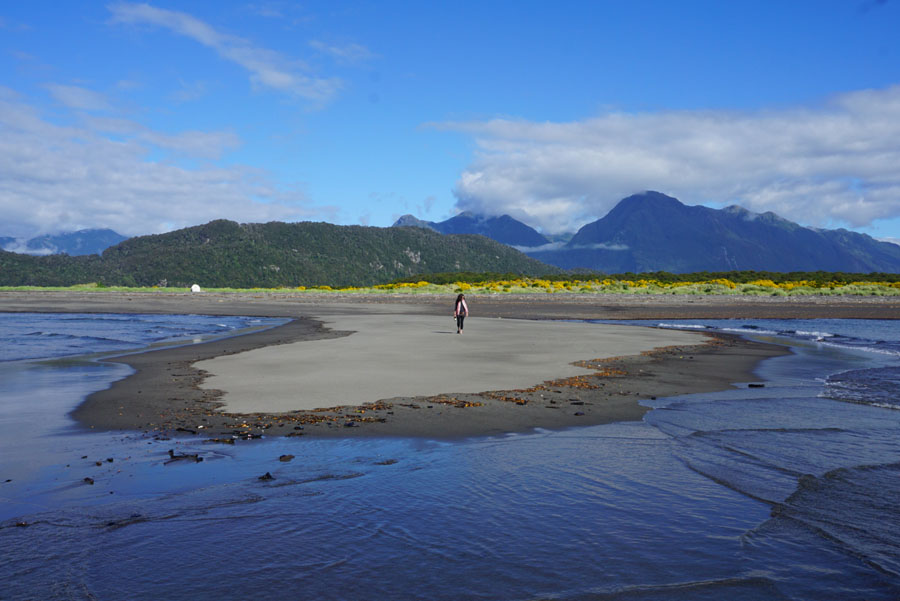
Camp: Dolphin Beach – find it on iOverlander. We had the whole beach to ourselves, picked a spot, and set up camp. Simple as that. Also, WE SAW DOLPHINS.
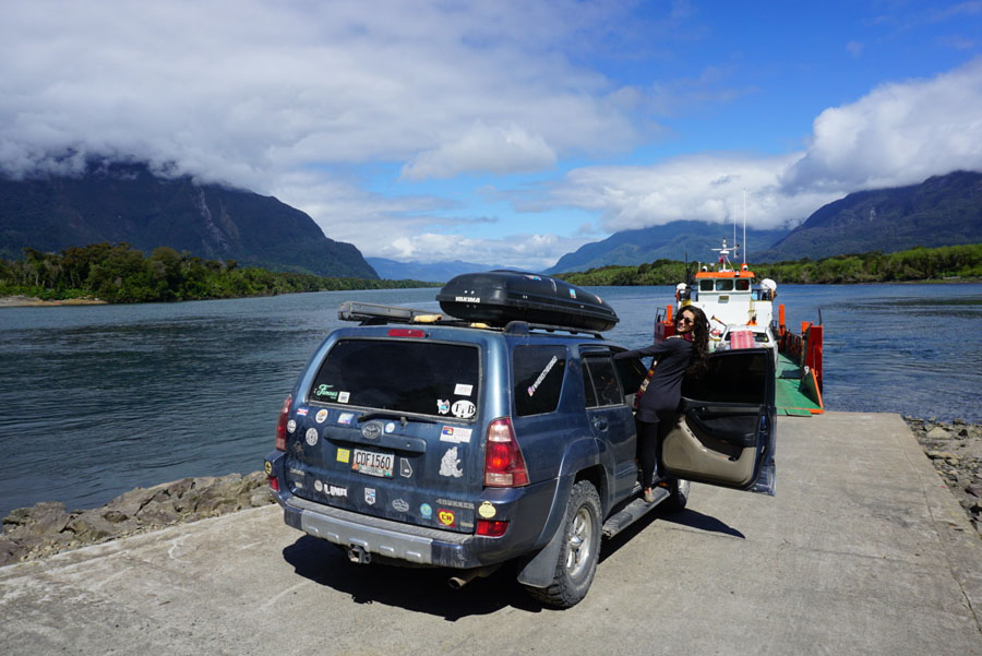
Notes: You must cross a river with a tiny ferry to get to Raúl Marin Balmaceda, but the ferry is on demand (and free), so you just show up and they will see you and come pick you up. Ferry runs from around 8 am until 6 pm, with a half-hour break from 1-1:30 pm for lunch.
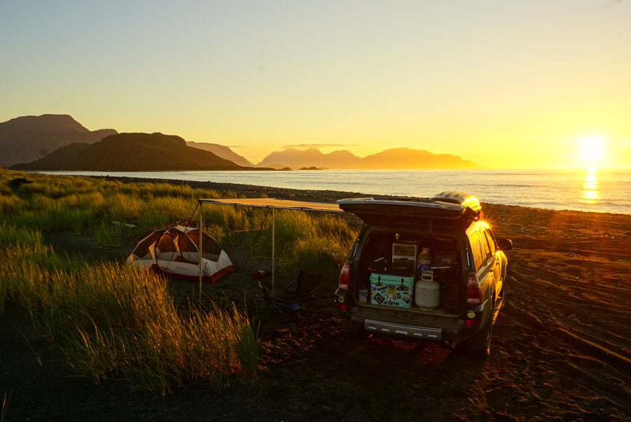
Day 9: Raúl Marin Balmaceda to Parque Nacional Queulat
Activities: After taking walks on the beach, hunting for driftwood, and watching the dolphins play in the bay (yeah, seriously), we drove back to the Carretera Austral from the coast (about 1.5 hours), and continued down to Queulat.
Camp: We wild camped directly outside the fence of the national park, on a nice hidden side road. You can find this spot on iOverlander.
Notes: There was paving construction and we had to take an obligatory detour ferry for part of this route, which delayed us. Camping at the park closes by 5-6pm, and we missed it so they wouldn’t let us camp inside.
Day 10: Parque Nacional Queulat to Puerto Cisnes
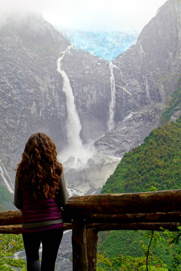
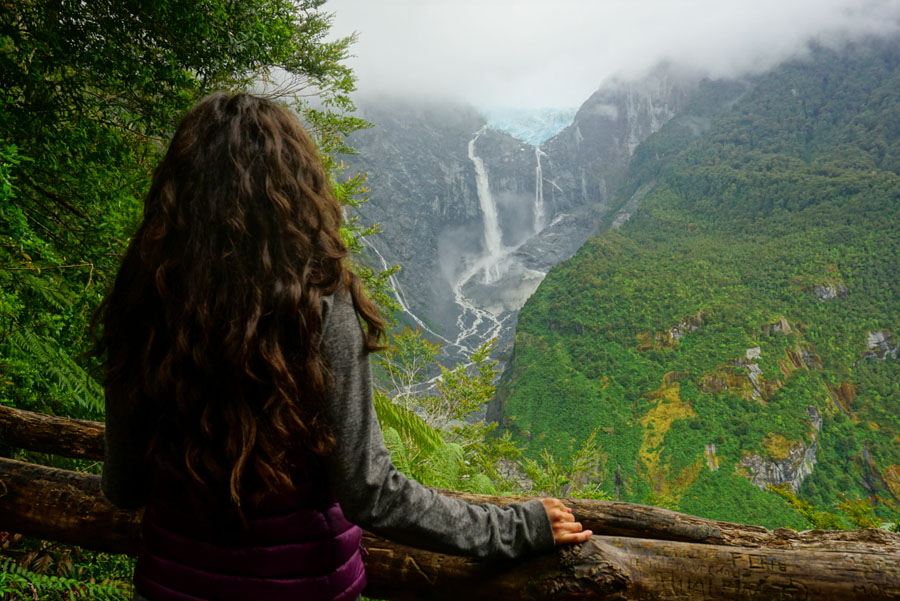
MUST-DO: DO NOT MISS the hanging glacier (Ventisquero Colgante) in Queulat National Park. Even on a cloudy day, the clouds usually sit just above the glacier, so the hike to the viewpoint is still worth it.
Activities: There are two viewpoints you can walk to, one close and one about an hour up the trail. Do the longer one, the view is unreal. There is a boat ride that takes about 20 minutes and costs 5,000 CLP, it takes you as close as you can get on the water to the waterfall. We did not do this, and I can’t imagine the view would be better than from the viewpoint, so either do both or do the hike, but don’t miss the hike.
Notes: Queulat means “the sound of the waterfalls” in the language of this region’s original inhabitants, the Chono people. The park opens at 8 am and there is a 5,000 CLP pp fee to enter. The park does close at 6:30 pm, so if you aren’t camping inside (also 5,000 CLP pp), you must exit. The drive from here to Puerto Cisnes (also off the Carretera Austral) is beautiful!
Camp: For wild camping at Puerto Cisnes, there is a spot across the bay from the town where there is a community park area, and you can camp on the very edge of it for free. Find it on iOverlander.
Beer: There is a cervecería in Puerto Cisnes that has a delicious porter!
Day 11-12: Coyhaique
Laundry: Get it done at Lavaseco on Calle Parra for 1,800 CLP per kilo, washed and dried and delivered next day (this was the best deal in town).
Camp: You can camp at “El Camping” which does fill up so don’t arrive too late. We stayed at an Airbnb for a few nights to regroup and pick up Ford’s brother from the airport in Balmaceda (Sky Airline services Balmaceda Airport – this is the only public airport in the middle of Carretera Austral).
Notes: Coyhaique is the biggest town in the whole region, with a population of around 50,000. It is a good place to restock groceries, take a break, eat hot meals and drink craft beer. Go to the tourist information office near the main plaza and get MAPS of the region and the Carretera Austral for free! There is a big grocery store called Unimarc in Coyhaique where you can restock and get some good food shopping done before continuing on your way.
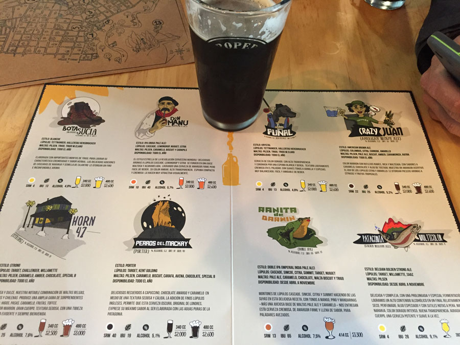
Beer: Cervecería Tropera has delicious burgers and good beer, I recommend the Brown Ale. (There is another location in Puerto Varas called Casa Tropera where you can find these beers).
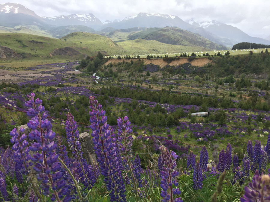
Day 13: Coyhaique to Cerro Castillo
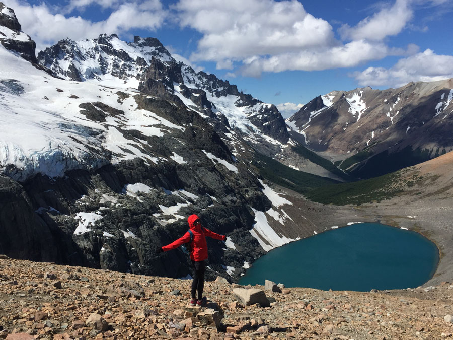
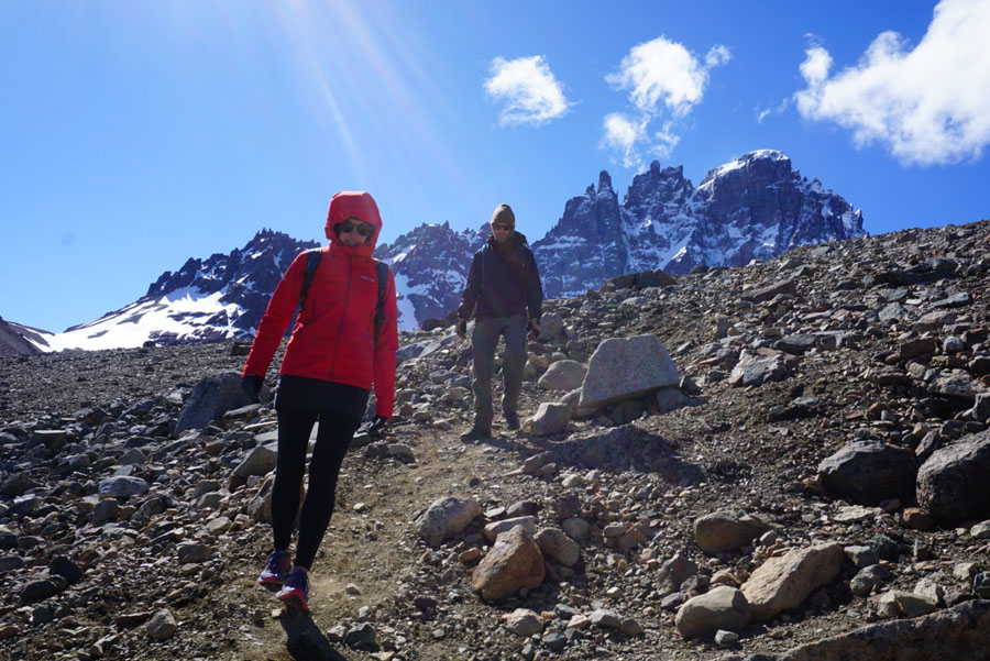
MUST-DO: DO NOT MISS Cerro Castillo. The views of the mountains and valley here are ridiculous, and I’ve deemed it the best-kept secret in Chilean Patagonia.
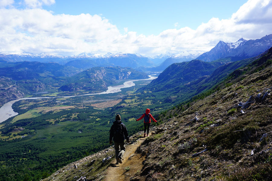
Activities: Do the hike to the mirador up on the mountain. If you enter through the main trailhead, it costs 10,000 CLP per person. We opted to do a bigger loop (10 miles) and drove about 6 km further down the road to another entrance towards Camping Neozelandés. We entered from here and hiked up to the mirador, coming down the way that most people opt to hike up. We really enjoyed the views and the level of steepness going in this direction. It is a scree field towards the top, be cautious with strong winds. You may be stopped to pay 2,000 CLP at a couple of different locations along the way, where property ownership changes, but we weren’t.
Camp: Senderos Patagonia in Villa Cerro Castillo is the place to be. It has spaces for tent camping, plenty of parking for car campers, and even hammocks protected from the wind if you want to sleep outside. The cozy common area has wonderful hot showers, and a nice guest kitchen and fireplace.
Notes: If you opt to do the bigger loop as we did, you’ll need to hitch a ride back to your car (which is about 6 km away from where you end up). If there is no one at the bottom to take you (by hitching a ride), simply walk back to Senderos Patagonia (about a mile) and you can get a ride from there. The trailheads and the camping are all clearly marked on maps.me. Also if you go to Senderos Patagonia, say hi to Mary for me (she’s from Ohio, owns the place, and is a lovely human).
Day 14: Cerro Castillo to Rio Ibañez
Activities: Hiking and climbing with views of Lago General Carrera and Cerro Castillo in the distance.
Camp: Because of people we met on the way, we got hooked up with a free place to camp for the night on some private land. There are other places to wild camp in this area, and you might meet people on the way who invite you to camp on their land, too!
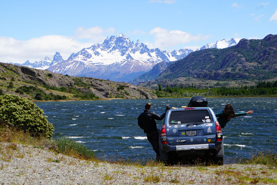
Day 15: Coyhaique
Went back to Coyhaique to pick up our fourth crew member (Ford’s brother’s gf) for the rest of our trip down the Carretera Austral. Yes – we ALL fit quite tightly in Cielito Lindo!
Camp: El Camping, which is conveniently located very close to Cervecería Tropera, you can guess where we spent our evening.
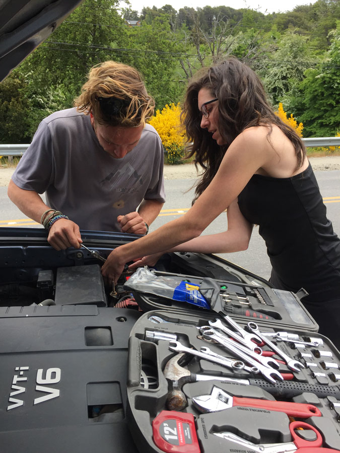
Day 16: Coyhaique to Puerto Rio Tranquilo
Notes: Rio Tranquilo is where access to the famous Marble Caves is, so we planned to get here to camp and do the caves the next day. There is no cell phone service and very little WiFi anywhere close to here for days.
Camp: Before getting to Puerto Rio Tranquilo, we took a left down towards Puerto Sanchez and stopped to wild camp along the beach at Bahía Murta. There are bathrooms you can use at the tourist office there. Again, find it on iOverlander.
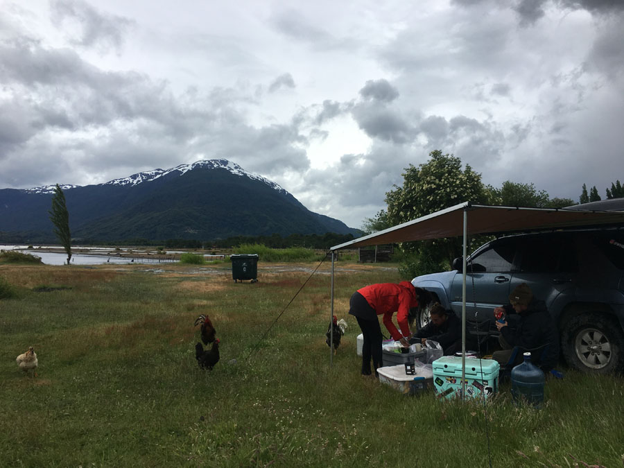
Day 17: Puerto Rio Tranquilo to Glacier Exploradores
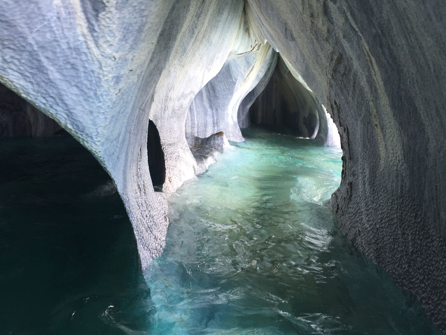
Activities: Marble Caves: You can either do a guided kayak tour to the marble caves or take a boat tour from the marina with most tourists. We opted for the boat at 10,000 CLP per person as opposed to the kayaks at 42,000 CLP per person. As long as the port is open (extreme weather makes this unpredictable), the boats go several times a day, and you can find a boat right in the center of town at the beach. For the kayak tours, go to the tourism kiosk on the right as you enter the center of town, which also shares an office with El Puesto Expediciones, who can set you up for kayaking. If you take a boat tour, try to get Jorge as your guide, he completely makes the tour and will have you crying in laughter.
Notes: The marble caves are in Lake General Carrera, the same lake on which The North Face founder Doug Tompkins passed away in a tragic kayaking accident in 2015 due to extreme weather. If you go out on the water yourself, please heed weather warnings and be safe.
Beer: Across the street from the beach is Cervecería Arisca, which may or may not have functioning WiFi (not when we were there), but does have decent craft beer.
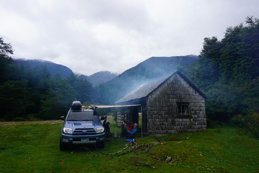
Camp: There is no wild camping in Puerto Rio Tranquilo, so we headed west up the canyon towards Glacier Exploradores, which was a BEAUTIFUL drive. It began to pour rain on us, so we found an abandoned shack alongside the road where we set up camp inside for the night and had a really wonderful and cozy adventure. We found it on iOverlander. If it weren’t pouring rain, we probably would have opted for an outdoor site, but this shack made our experience perfect and fun. Only in Patagonia…
Day 18: Glacier Exploradores to Cochrane
Activities: Glacier Exploradores: There are two ways to see Glacier Exploradores. You can either hire a guide and do a full-day trek onto the glacier (this is run by CONAF), or you can pay 4,000 CLP pp a little further up the road to do a 15-minute hike up to a mirador (this is privately operated). We opted for the 15-minute hike to the Mirador. In my opinion and based on my experience with other Patagonian glaciers, this one is the least beautiful. It was very sub-par compared to Perito Moreno, which is an absolute must in Southern Argentina, or even Glacier Grey in Torres del Paine, Chile. What is unique about Exploradores is that from the viewpoint it looks very “caught in the act” of receding, leaving behind massive undulations of the earth.
More Activities: Heading south, stop at the confluence of Rio Baker and Rio Nef. There is a trailhead from a parking lot on the side of the highway. It only takes about 10 minutes to walk the 700m down to the confluence and it is certainly worth it, even in the rain. If you read about Patagonia Sin Represas, which I mentioned above, you will remember that Rio Baker is one of the two main rivers that were protected from the threat of dams. The confluence is strong and beautiful.
Beer: There is a cervecería in Cochrane where you can find some local craft beer and even half-functioning WiFi.
Notes: Gas is cheaper in Puerto Tranquilo than Cochrane, fill up before you head south.
Border Crossings: There is a police station in Cochrane at the NE corner of the main plaza where you can go in and ask about which borders are open. This was very important to us in our car, and we found out that the only one open for driving a car across was just north of us at Paso Roballos. This meant backtracking no matter what. The traditional end of the Carretera Austral is Villa O’Higgins, but there is no way to drive into Argentina from there, which means coming back to Paso Roballos. Since there is another long ferry crossing to get to Villa O’Higgins, we decided to skip it altogether since we’d have to do it all twice. If you are on foot, you can make the 22km crossing into El Chaltén by trail.
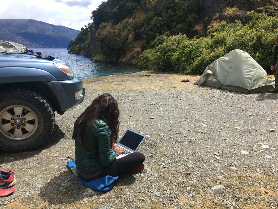
Camp: We wild camped at Lake Cochrane about 16km out of town. Find it on iOverlander. It was a beautiful, secluded lot on the edge of the lakeshore and made for a very nice campsite for the night. It is east of Cochrane, so you’ll have to drive back to town to continue south.
Day 19: Cochrane to Caleta Tortel
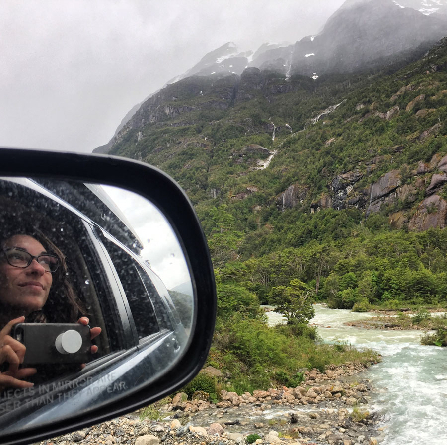
Activities: Stop along the drive for all the photos, this is a BEAUTIFUL stretch of the Carretera Austral.
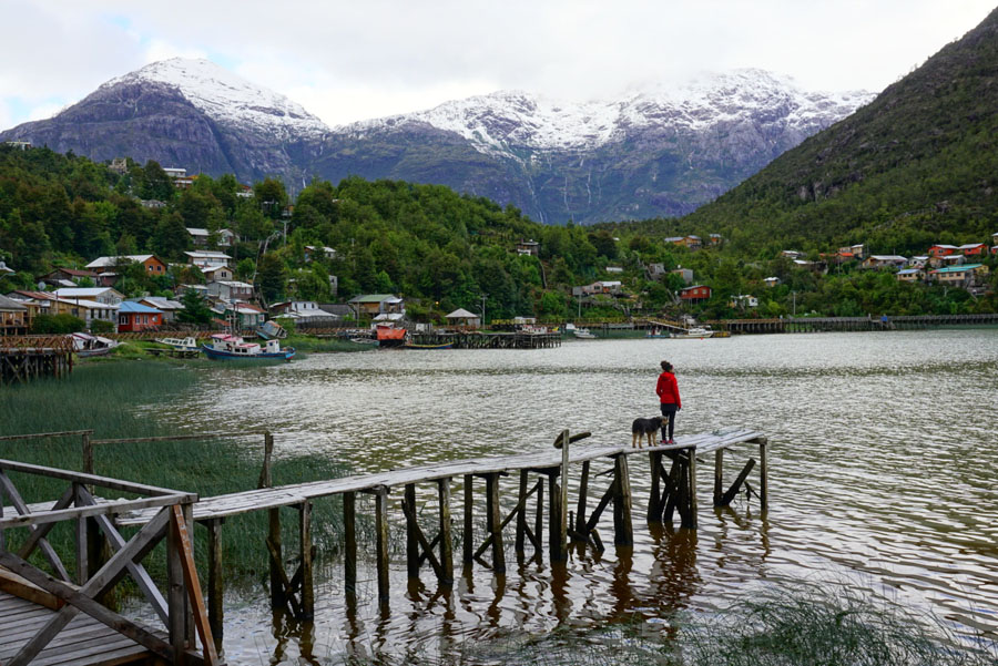
MUST-DO: Caleta Tortel is a unique and picturesque village at the edge of a fjord, made of wooden boardwalks. It’s worth seeing. Park in the roundabout (you can’t drive any further) and walk all the way to the end of the boardwalks, about 2-miles one way. Then either turn around and come back or hike up and over the mountain for gorgeous views (the trail is on maps.me) back to the parking lot.
Camp: We opted to head back north after a few lovely hours in Tortel, and we wild camped on the edge of Rio Baker at a nice little clearing that we found on iOverlander.
Notes: Stock up on fresh water before you leave Cochrane, the water in the public taps in Tortel was straight up brown.
Day 20: Parque Patagonia
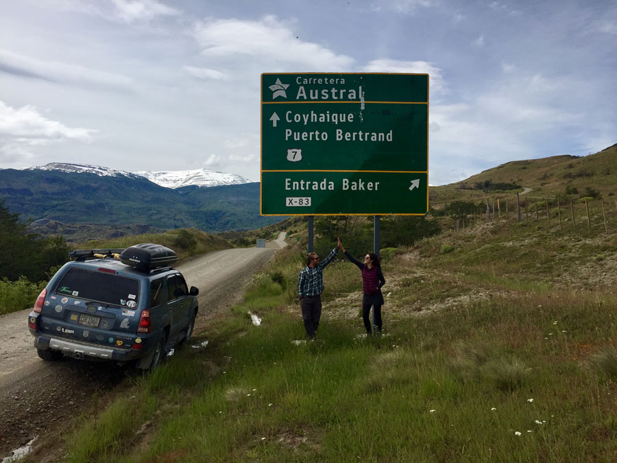
Drove back up through Cochrane, stopping once more for gas and groceries and a picnic in the park, then continued north to Parque Patagonia, which is on the same road as Entrada Baker or Paso Roballos (the border crossing into Argentina).
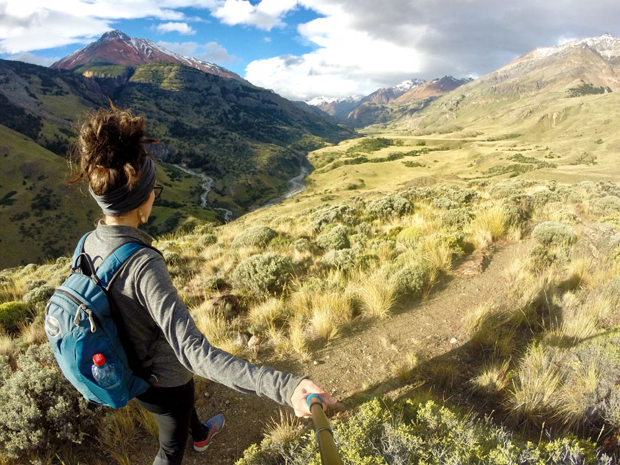
Activities: Lagunas Altas is the more popular hike in Parque Patagonia, but we didn’t have enough time for it, so we continued east to the next campground at Casa Piedra. Here we hiked the Avilés trail, a 10-mile hike which we started at 6 pm and made it back exactly by 10 pm, still plenty of daylight! This hike was GORGEOUS and I highly recommend it. It is a loop that follows a river, and when you reach the end you cross a suspension bridge over a gorge and hike back on the other side of the river.
Camp: There are a couple of different campsites for 8,000 CLP pp within Parque Patagonia, which stretches from the Carretera Austral all the way to Argentina. Parque Patagonia is one of the efforts of Tompkins Conservation and it is pristine and beautiful, just like Parque Pumalín up north.
Day 21: Parque Patagonia to El Chaltén, Argentina
It was Christmas Eve, and we didn’t want to be in the middle of BFN, Argentina for Christmas, so we drove about 600km that day all the way from Parque Patagonia to El Chaltén, Argentina.
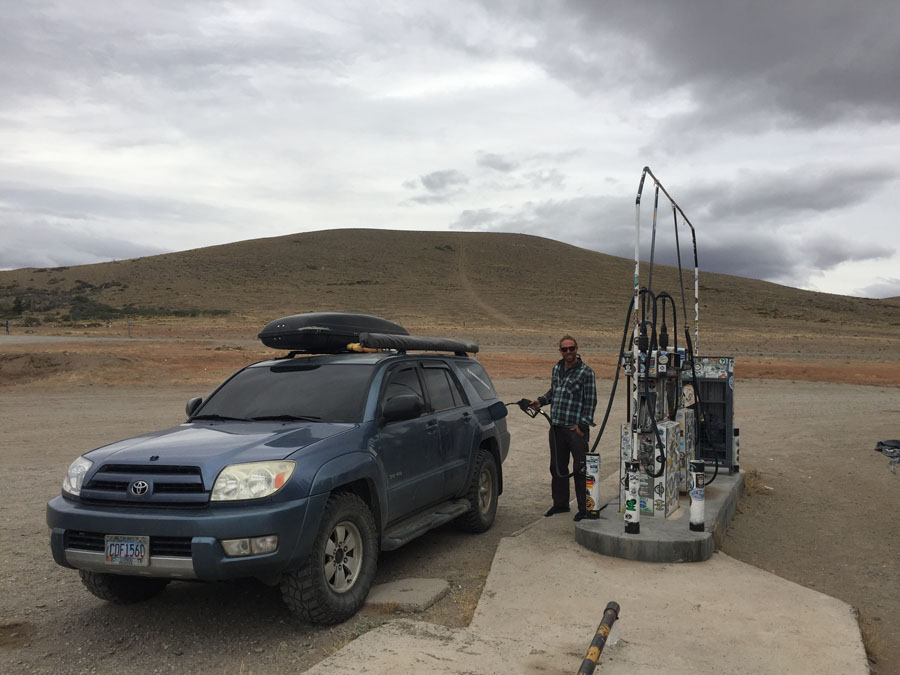
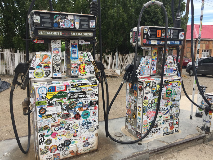
Notes: This border at Paso Roballos is completely remote, do not expect any services for hundreds of kilometers. There are 11km between checkpoints, and the No Man’s Land here is other-worldly beautiful. The customs officers were very nice on both sides and we had no trouble at all crossing in Argentina. The next “gas station” (a pump in the middle of nowhere) was $5.36/gallon (especially at the time this was VERY high) and had a small convenience store and bathroom in Bajo Caracoles. That’s where you hit the famous Argentinian Route 40. The next gas after that was Gobernador Gregores, and that gas station has free WiFi and delicious empanadas, also probably a must-do by default.
Camp: We treated ourselves to a roof for Christmas, staying at the historic Fitz Roy Inn for a couple of nights.
This was my third time visiting El Chaltén, and I blissfully stayed for the next 10 days before continuing on with the crew to Puero Natales, where we parted ways. Ford and his brother continued all the way to Ushuaia, where he ended his two year drive down the Pan-American Highway.
Carretera Austral By the Numbers
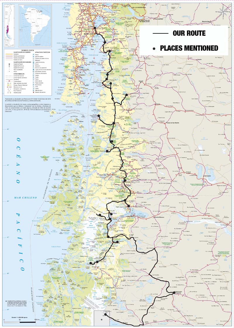
- We drove about 2,200 km or around 1,400 miles on and around and back and forth on the Carretera Austral from our start in Puerto Varas to our crossing into Argentina (map below).
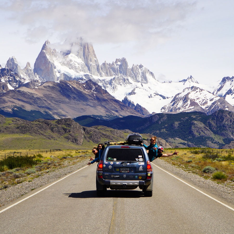
- We started with 2 people (Ford and me) for the first 2 weeks, then added 2 more (Ford’s brother and his girlfriend) for the last 2 weeks. We lovingly called ourselves the #PatagucciGang. Cielito Lindo couldn’t possibly pack in anything else.
- My latest passport was issued in July of 2016. Of the 19 total stamps that are in it, 17 of them are from Chile and Argentina. #askmewhatmyfavoriteplaceisonemoretime
- There are SO many people with “M” names in Chile. I nearly screwed myself out of a hotel reservation during peak season because I confirmed the wrong dates with the wrong “M” over email. At that time, I was in daily communication with a Marcela, Marcelo, Marilia, Mauricio, Michal, Mary, and TWO Mariajoses, ALL for different reasons, none from the same place or company.
- We slept inside 4 nights.
- I spent 15 nights in tents, 2 in tree houses, and 1 in an abandoned mountain hut.
- I had exactly 2 hot showers, 2 glacial cold showers, countless baby wipe baths, 1 river bath, and 2 wood-fired hot tubs.
- We took 5 ferries.
- We ate more salchicha (hot dog) than I care to admit or think about.
- We had only a handful of hours of WiFi or cell service the entire time, none of which was even close to strong enough to stream Game of Thrones. #winterisgone
- In #Argentina, it took 4 days to download 20% of an audiobook, which I started listening to, and when I hit the end of the downloaded section, it erased and had to start downloading from the beginning all over again. #palmtoforehead
- Cheap wine in Chile (about $3-4/bottle) is way, WAY better than cheap wine in Argentina, but Argentina is the producer of a new favorite: Torrontes.
Carretera Austral Conclusions
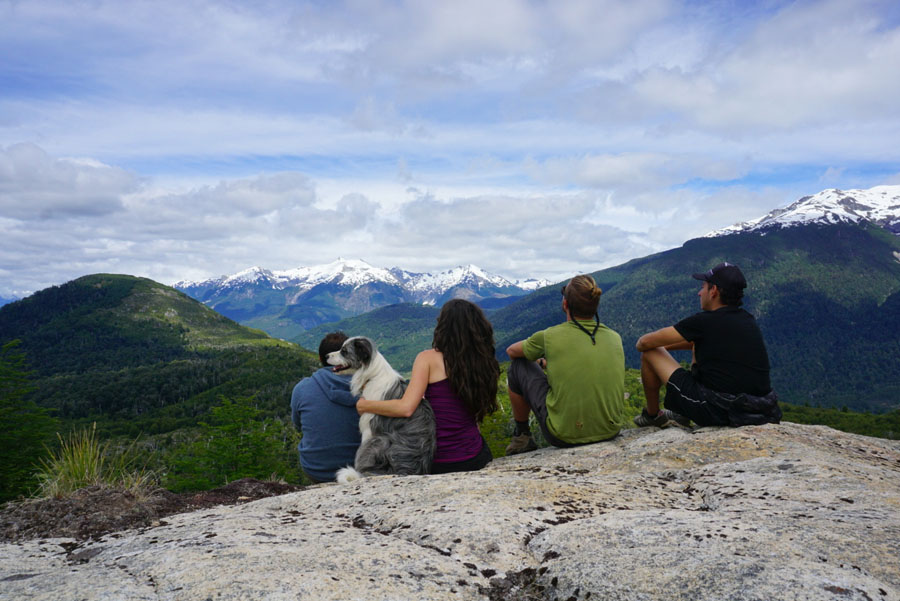
These three weeks on the Carretera Austral were three of the most adventurous and free of my life. About halfway through, I posted this on Facebook:
“We have been wild camping a lot, and there is no threat of animals here (a strange thing for a girl from bear country). Every day is a new adventure, every new section of the road seems more beautiful than the last. The sun has been shining every day for us, and it didn’t take us long to find our new favorite Chilean red wine.
I feel removed down here.
We are so far from normal civilization. And as you road trip lovers know, everything changes when you have your own car. We are moving at our own pace, hiking where we want to hike, seeing what we want to see.
Today we went on our third glacier hike to see a hanging glacier. Third! And it was the most mind-blowing yet. The landscapes we have seen are some of the most beautiful on the planet. I’m so grateful to be experiencing this, even with so much time completely off grid. I don’t think I’ve ever felt so free.”
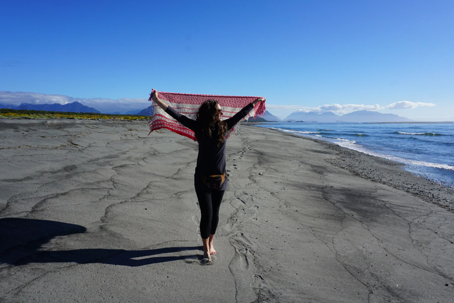
The raw, wild beauty of Chilean Patagonia has completely won me over all over again. It has my heart, and that is what I know. What I don’t know and the question I’m still asking is, where can I possibly go from here? What tops the Carretera Austral?
For me, even with the plethora of personal and logistical challenges that this trip presented (because no trip comes without them), these three crazy beautiful weeks will be some of the most memorable of all of my travels, for the rest of my life. I’m more than grateful to have had the opportunity to experience the Carretera Austral like this for the first time.
Map of the Carretera Austral

Stop by the tourist office near the main plaza in Coyhaique to get free maps of the Carretera Austral.
Make it easy: If YOU want to drive the Carretera Austral, reach out to EcoChile to arrange your trip details. Tell them Traveling Jackie sent you and save 5% off ANY trip you book with them!


